Alabama is a state of the United States of America located in the Southeastern region of the country, whereas Zambia is a landlocked country at the crossroads of Central, Southern, and East Africa. Today in this article, we will discuss the comparison between Alabama and Zambia regarding various aspects.
Size
Is Alabama bigger than Zambia?
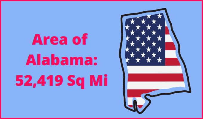
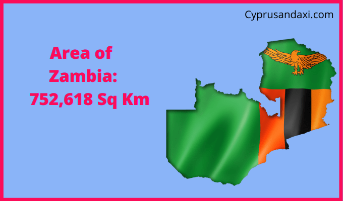
The total area of Alabama is 52,419 sq mi, and the total area of Zambia is 290,587 sq mi. Alabama is smaller than Zambia by 238,168 sq mi. Alabama is around 5.55 times smaller than Zambia.
Area of Alabama: 52,419 sq mi ( 135,765 km2 )
Area of Zambia: 290,587 sq mi ( 752,618 km2 )
Population
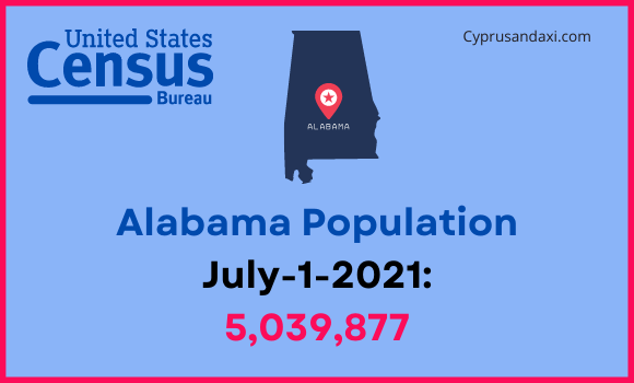
According to the United States Census Bureau, the total population of Alabama as of 1st July 2021, was estimated to be around 5,039,877.
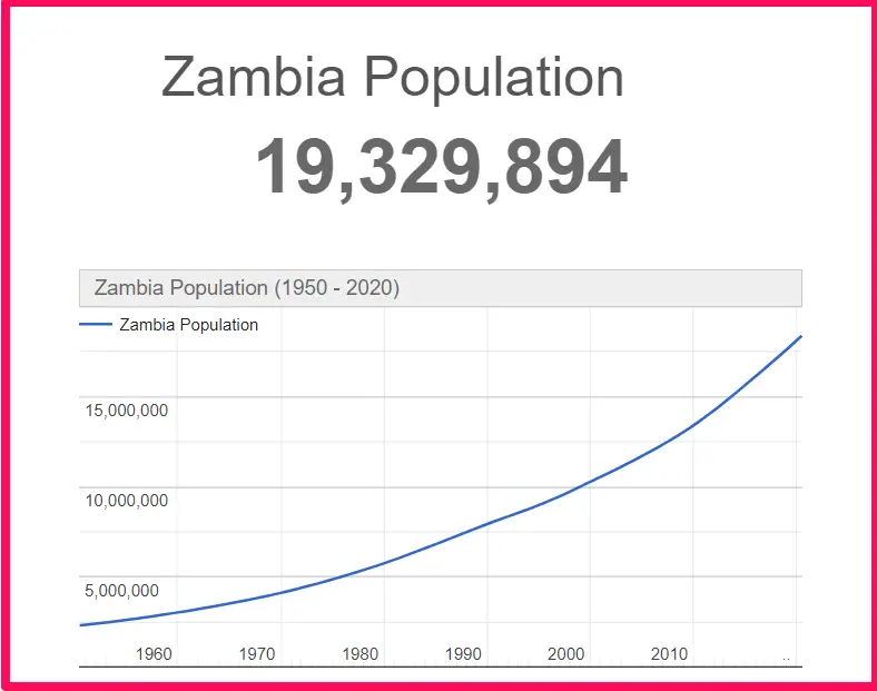
Based on the Worldometer elaboration of the latest United Nations data, the total population of Zambia as of 31st March 2022, is estimated to be around 19,329,894.
Here is some more data comparison between Alabama and Zambia.
The capital of Alabama is Montgomery, and the capital city of Zambia is Lusaka.
Official Languages
Alabama: English
Zambia: English
Demonym(s)
Alabama: Alabamian, Alabaman
Zambia: Zambian
ISO 3166 Code
Alabama: US-AL
Zambia: ZM
Human Development Index
HDI of Alabama as of 2019: 0.886
HDI of Zambia as of 2019: 0.584
Alabama Time Zone:
UTC – 6 (Central Standard Time)
Summer (DST):
UTC – 5 (Central Daylight Time)
Zambia Time Zone:
UTC + 2 (Central Africa Time)
Geological Coordinates
Coordinates of Alabama:
32° 46′ 45.84″ N, 86° 49′ 43.32″ W
Coordinates of Zambia:
15° 0′ 0″ S, 30° 0′ 0″ E
You may also like to read:
Alabama vs Toronto (Ontario) Comparison