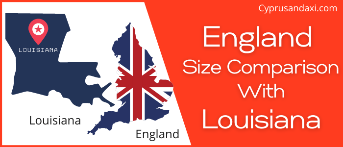
England is a country located in Europe and is a part of the United Kingdom, whereas Louisiana is a state in the Deep South and South Central regions of the United States of America. Today in this article, we will discuss the comparison between England and Louisiana regarding various aspects.
Size
Is England bigger than Louisiana?
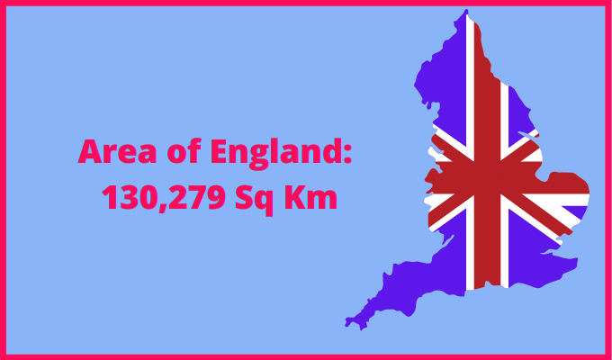
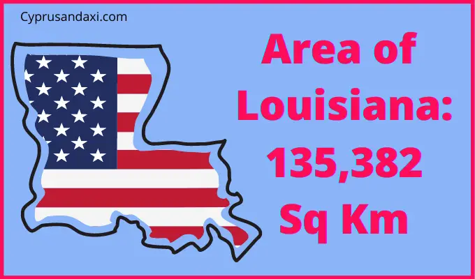
The total area of England is 130,279 sq km, and the total area of Louisiana is 135,382 sq km. England is smaller than Louisiana by 5,103 sq km. England is around 1.03 times smaller than Louisiana.
Area of England: 50,301 sq mi ( 130,279 km2 )
Area of Louisiana: 52,069.13 sq mi ( 135,382 km2 )
Population
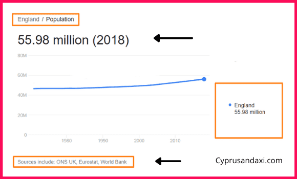
According to the World Bank, ONS UK, and Eurostat, the total population of England as of 2018 was estimated to be around 55.98 Million.
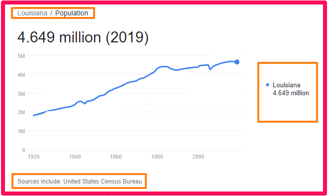
Based on the United States Census Bureau data, the total population of Louisiana as of 2019 was estimated to be around 4.649 Million.
Here is some more data comparison between England and Louisiana.
The capital city of England is London, and the capital city of Louisiana is Baton Rouge.
Official Languages
England: English
Louisiana: No official language
Human Development Index
HDI of England as of 2019: 0.932
HDI of Louisiana as of 2018: 0.885
England Timezone:
UTC (Greenwich Mean Time)
Summer (DST):
UTC + 1 (British Summer Time)
Louisiana Timezone:
UTC − 6 (Central Time Zone)
Summer (DST):
UTC − 5 (Central Daylight Time)
Geological Coordinates
Coordinates of England:
53° 0′ 0″ N, 1° 0′ 0″ W
Coordinates of Louisiana:
31° 4′ 8.04″ N, 91° 59′ 48.48″ W
You may also like to read:
Is England bigger than Manitoba?