Alabama is a state of the United States of America located in the Southeastern region of the country, whereas British Columbia is one of the provinces of Canada situated in the westernmost part of the country. Today in this article, we will discuss the comparison between Alabama and British Columbia regarding various aspects.
Size
Is Alabama bigger than British Columbia?
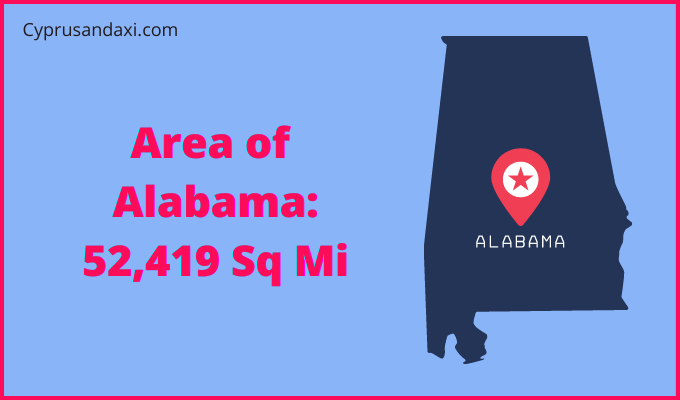
The total area of Alabama is 52,419 sq mi, and the total area of British Columbia is 364,764 sq mi. Alabama is smaller than British Columbia by 312,345 sq mi. Alabama is around 6.96 times smaller than British Columbia.
Area of Alabama: 52,419 sq mi ( 135,765 km2 )
Area of British Columbia: 364,764 sq mi ( 944,735 km2 )

Population
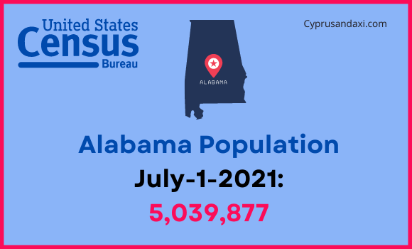
According to the United States Census Bureau, the total population of Alabama as of 1st July 2021, was estimated to be around 5,039,877.
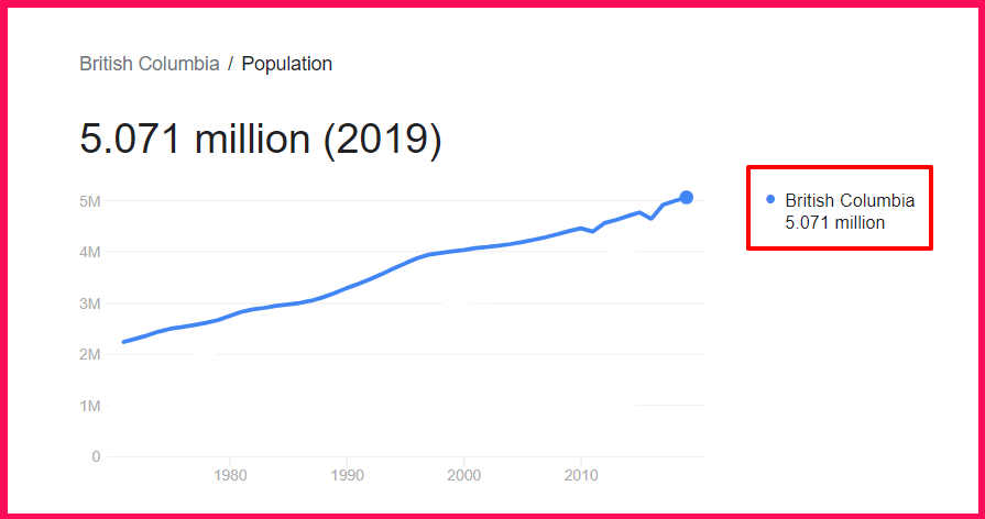
Based on the StatCan data, the population of British Columbia as of 2019 was estimated to be around 5.071 Million.
Here is some more data comparison between Alabama and British Columbia.
The capital of Alabama is Montgomery, and the capital city of British Columbia is Victoria.
Official Languages
Alabama: English
British Columbia: English, French
Demonym(s)
Alabama: Alabamian, Alabaman
British Columbia: British Columbian
ISO 3166 Code
Alabama: US-AL
British Columbia: CA-BC
Human Development Index
HDI of Alabama as of 2019: 0.886
HDI of British Columbia as of 2019: 0.938
Alabama Time Zone:
UTC – 6 (Central Standard Time)
Summer (DST):
UTC – 5 (Central Daylight Time)
British Columbia Time Zone:
UTC − 8 (Pacific Time Zone)
UTC − 7 (Mountain Time Zone)
Summer (DST):
UTC − 7 (Pacific Daylight Time)
UTC − 6 (Mountain Daylight Time)
Geological Coordinates
Coordinates of Alabama:
32° 46′ 45.84″ N, 86° 49′ 43.32″ W
Coordinates of British Columbia:
54° 0′ 0″ N, 125° 0′ 0″ W
You may also like to read:
