Michigan is a state located in the upper Midwestern region of the United States of America, whereas Vermont is a state located in the New England region of the United States of America. Today in this article, we will discuss the comparison between Michigan and Vermont regarding various aspects.
Size
Is Michigan bigger than Vermont?
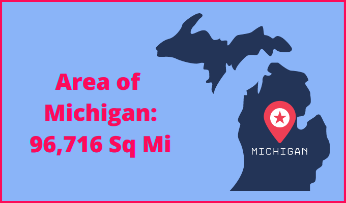
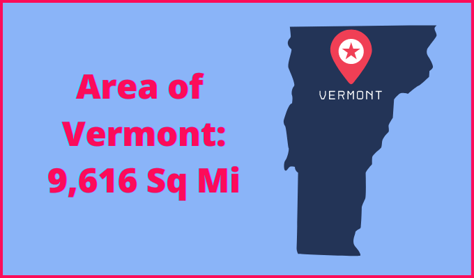
The total area of Michigan is 96,716 sq mi, and the total area of Vermont is 9,616 sq mi. Michigan is bigger than Vermont by 87,100 sq mi. Michigan is around 10.06 times bigger than Vermont.
Area of Michigan: 96,716 sq mi ( 250,493 km2 )
Area of Vermont: 9,616 sq mi ( 24,923 km2 )
Population
According to the United States Census Bureau, the total population of Michigan as of 1st July 2021 was estimated to be around 10,050,811.

Based on the data provided by the United States Census Bureau, the total population of Vermont as of 1st July 2021 was estimated to be around 645,570.

Here is some more data comparison between Michigan and Vermont.
The capital city of Michigan is Lansing, and the capital city of Vermont is Montpelier.
Largest City
Michigan: Detroit
Vermont: Burlington
Demonym(s)
Michigan: Michigander, Michiganian
Vermont: Vermonter
Official Languages
Michigan: None
Vermont: None
ISO 3166 Code
Michigan: US-MI
Vermont: US-VT
Human Development Index
HDI of Michigan as of 2019: 0.918
HDI of Vermont as of 2019: 0.940
Michigan Time Zone:
Most of the state
UTC – 5 (Eastern Standard Time)
Summer(DST):
UTC – 4 (Eastern Daylight Time)
4 counties
UTC – 5 (Central Standard Time)
Summer(DST):
UTC – 4 (Central Daylight Time)
Vermont Time Zone:
UTC − 5 (Eastern Standard Time)
Summer (DST):
UTC − 4 (Eastern Daylight Time)
Geological Coordinates
Coordinates of Michigan:
44° 20′ 48.12″ N, 85° 24′ 36.72″ W
Coordinates of Vermont:
44° 0′ 0″ N, 72° 42′ 0″ W
You may also like to read:
